Day 0: Finding the bus to Mangalore in heavy rains (with our bikes)
Day 1: Mangalore to Malpe Beach, Udupi, St. Mary's Island
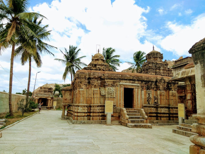
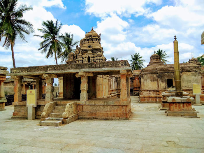
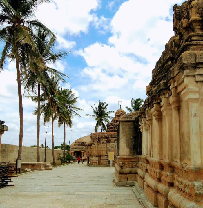
Day 2: Murdeshwar
Day 3: Gokarna
Day 4: Karwar, Polem, Palolem
Day 5: Agonda, Cola, Panjim to Bangalore
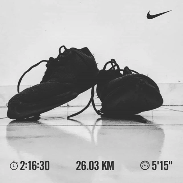
Note: The post is slightly detailed. I wanted to keep it detailed because it’s fun to read it later. This trip took place from 01-10-2019 onwards, and I started writing this post on 7th Oct, but got it finished on 26th April.
I often open up Google Maps, and search for the places/routes to visit next. India’s west coast has always been in my mind. This route consisted of many good places I always liked, plus, our Bangalore-Sakleshpur-Chikamangalur trip had the Mangalore highway in 70% of the trip; which always kept me keen to go till Mangalore.
Two weeks before the long weekend, Parkar & me discussed about this route and finalized the day-wise plan in just one sitting - a 6 days trip. Nothing else planned though. Parkar took around 5-7 warm-up rides across Bangalore during this time, and 2 days before the trip, we went for another 60 km+ warm-up ride to Hennur Forest. I was relieved after going for this warm-up ride because the sore muscles got recovered by the next day - just before the trip and, getting ready for a daily 80-100 km ride was important.
Day 0: Finding the bus to Mangalore in heavy rains (with our bikes)
We did no prior bookings (buses and hotels) in advance since we were carrying bikes and things were not fully predictable. The weather forecast showed rains all along the route till next week. We packed all our gears, dry fruits, and other edibles, and left for the Majestic bus stand. It started raining heavily just after 2 km of start (around 8 PM). It seemed like the rain is not going to stop and we didn't want to negotiate with the last bus till Mangalore; so we wore our raincoat, kept our mobile in our raincoat's pocket and resumed. It was raining heavily. Risk apart, we always liked riding in the rains. At some places, half of the tires were submerged inside the logged water, but it was fun. This was the third time I was riding in such heavy rain and so much of water.
It took us around 30-45 mins to find, convince, negotiate with a bus conductor to allow to keep our bikes in the luggage. These were KSRTC Airavat multi-axle semi-sleeper buses. We kept the bikes in vertical position supported with the bike stand inside the luggage compartment.
Inside the bus, Parkar's phone was stuck in a boot loop, and we couldn't do anything to stop it. It kept restarting the whole night. My phone was working fine, but the moment I put it in charge, it probably short-circuited and the touch sensor stopped responding. Both our phones had stopped working. We learned that raincoat pockets are not waterproof.
While the bus left by 11:30 PM, I was also constantly worried about cycle getting damaged on the way, esp while crossing the ghats.
Day 1: Mangalore to Malpe Beach, Udupi, St. Mary's Island (62 km)
Getting good sleep in a semi-sleeper bus is tough, we took them because these buses have huge luggage compartments and they usually allow bikes. We got down at the Mangalore bus stand, put on our gears, and started the trip by 8 AM. This route was mostly highway - NH 66. We crossed many deltas, rivers as part of beautiful landscapes. At this point, I was slightly worried about our phones not working, but I wanted the experience to have completed this 6 days trip without phones or taking photos.
Around 1 PM, we crossed Udupi quite easily and before leaving the highway for Udupi, we found a mobile shop and enquired if mobiles could be repaired. Parkar's phone got fixed by drying out the moisture from the phone, while I had to get my screen replaced (with another broken screen because we couldn't find a new screen in that area). Once my mobile was on, the first thing I did was tranferred the house rent to my house owner in Bangalore. We asked the shopkeeper for a good place to eat - for which he suggested a local shop that cooked good sea fishes. (people are generally very helpful on the highways)
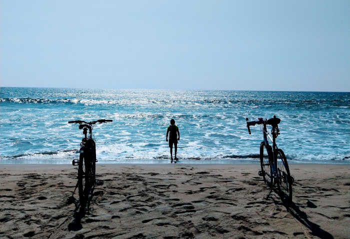
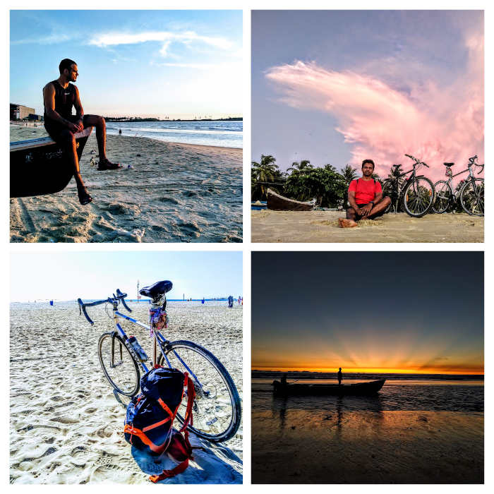
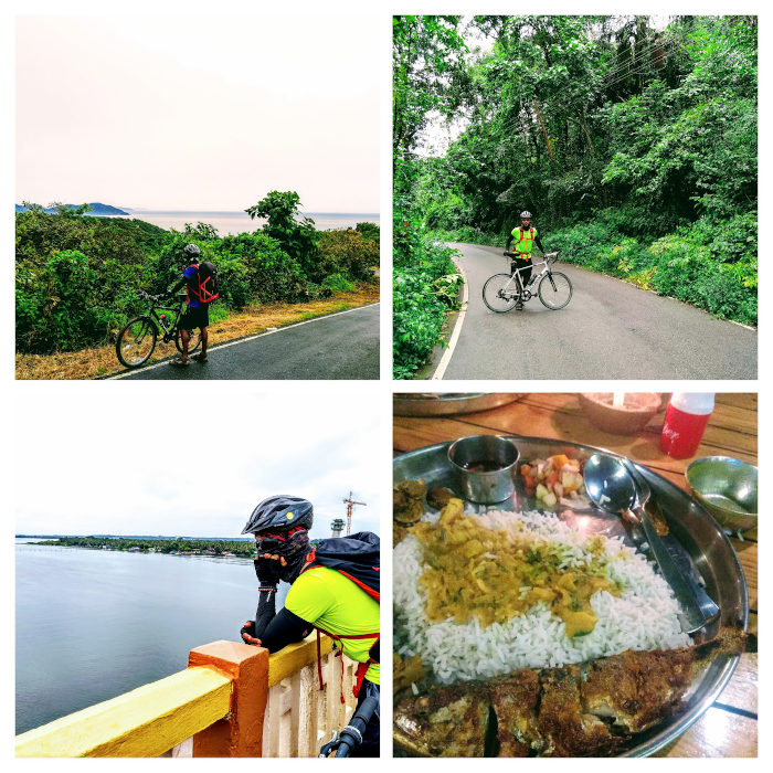
We somehow found the place he suggested and had amazing (literally) fish curry. We gorged on 3-4 types of fishes which were all mostly deep-fried. Later, we took some internal roads to reach Malpe Beach, which was pretty clean and almost empty in the afternoon. We found that boat service for St. Mary's Island is closed due to bad weather which was disappointing. So, we found a lodge nearby and took some rest. In the evening, we spent some time on the beach, watched the sunset, clicked some pictures and saw huge fish markets nearby, before having dinner at one of the shops - fish curry meal again.
Day 2: Murdeshwar (110 km)
I wouldn't say I had a very good sleep (neither did Parkar), maybe because we were not tired enough, or it wasn't home. We got up at around 6 AM, packed up, and left for Murdeshwar. Again, the route didn't disappoint us, and we crossed some beautiful landscapes which involved beaches, deltas, and ghats. Like most days, we had Idli at some local shop on the way for the breakfast.
Before coming for this trip, the weather forecast showed it'll rain for the whole week through the whole west coast. But it didn't - so far. We were having early lunch at some restaurant (Masala Dosa & coffee), and suddenly it started raining heavily. It was really bad and apparently, the people have been waiting for the rains for a couple of months. We decided we'll not wait for too long, and finally, wore the raincoat and started riding. Trust me on this, riding in the rains is indescribable - you've to experience this by yourself and especially when you're tired or on ghats.
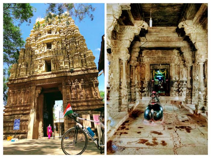
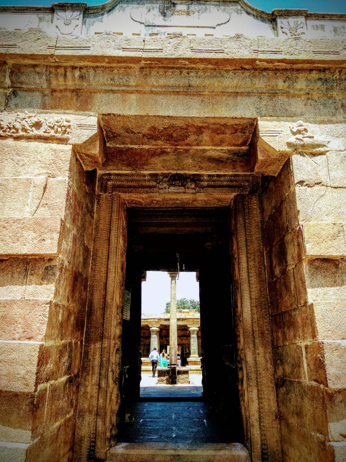
We rode in the rains for little over one hour. We reached the beach late afternoon, searched for a place to stay and went out to eat (fish curry meal again, and some boiled eggs). Finding a good place to stay as well as to eat was not easy here since this place was slightly crowded because of the popular temple at the beach.
By 5 PM, we were at the beach for the daily sunset session.😁 We finally saw a lot of humans here, and dogs of course, since most places we went to were usually empty. At the beach, while I was feeling a bit tired for some reason, Parkar met (unusual Parkar) a large group of cyclists who were coming from Goa. They suggested a couple of internal routes that we can take, as well as some good places to stop by. I was just lying down at beach, while Parkar talked for more than an hour. By 9 PM, we left the beach and went for dinner. Every night, we would buy a liter of milk and have a protein shake before sleeping. We generally ate a lot of food to not lose a lot of weight and muscles.
Day 3: Gokarna (80 km)
Last night's sleep was not good again. For the most part of the night, I wasn't sure if I was sleeping or I was awake. It was weird. We got up early and left for Gokarna, we were comparatively more excited about reaching Gokarna. The route was a bit different now, more hilly to be specific since we were at the edge of ghats. Hilly route is a different experience - the reason is the ups and downs that we get. At one moment you're pedaling some big slopes, and suddenly there is a downward slope for some time.
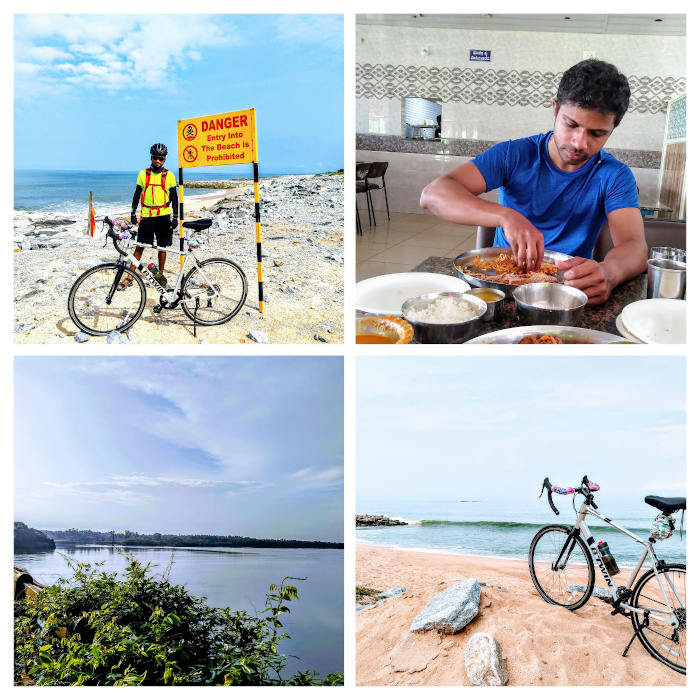
Suggested by the cyclists yesterday, we decided to stop by a small footbridge over some river (Saraswati I guess) which looked good in the photos too. Since my phone was broken, Parkar was navigating the directions, but like a fool, I was cycling ahead of him. Probably because of some good song in the earphones, I was riding with very good speed and suddenly I got a call from Parkar, only to realize that I had come far ahead of the location where we had to stop. I went back and took around 20 minutes to find him (~5 km). It was a good place, and the bridge so narrow that it acted like a one-way. At the other side of the bridge, there was a broken road that seemed to go towards Gokarna, which we wanted to take, but we didn't risk our tires for it - especially tires of my road bike.
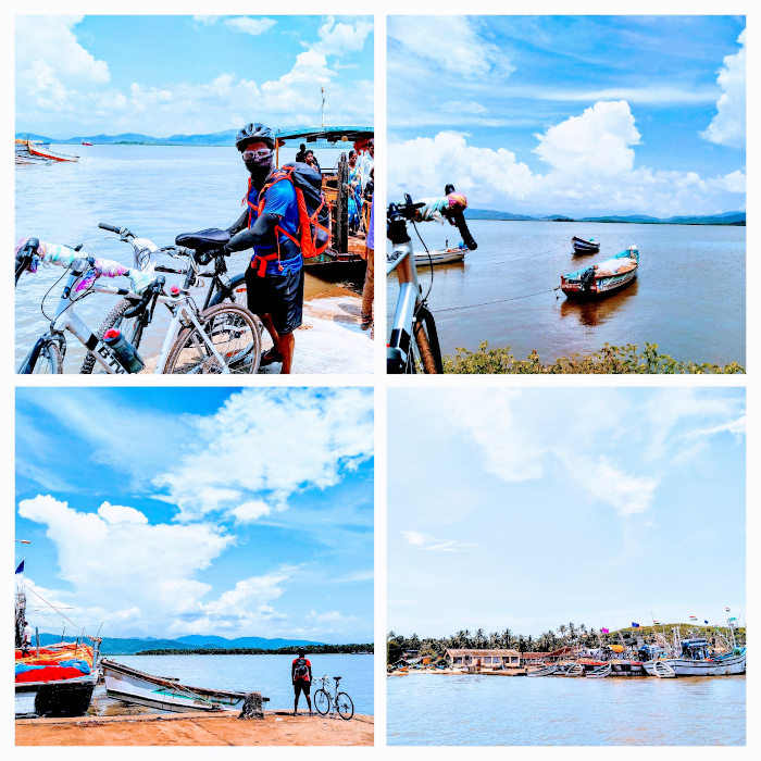
After a couple of hours, we decided to take an internal route and leave the highway (at Kumta). The good part was that this route went to Aghanashini Jetty which will directly drop us at "God's Own Beach" in Gokarna by a ferry. The bad part was that, for this odd 20 km, we had no idea about the condition of the roads. But we were excited and went for it.
This was an amazing route. Roads were good, jungles, full of trees, and hilly terrain. As we were getting close to the shore, the slope of the road was suddenly increasing. It was a sudden change, and at a few places, we even had to walk upwards. I think the roads were at 60-70 degrees angle for some time. At the peak, we were able to clearly see nearby beaches, deltas, and Gokarna! Just like how we reached on the top, there was a sudden downward slope for the next 5kms on the narrow roads. There were no vehicles on this road. The downward slope directly landed us at the ferry station, which happened very quickly. It was around 1 pm and even in the bright sun, the landscape from the ferry was mesmerizing, clouds were clear, a mix of hot and cold breezes, and we had finally touched Gokarna (my first time). The surprising part was that we just had to pay 10 bucks for the ferry ride.
Through the jungles and hilly routes in that part of Gokarna, we reached the Main beach by 3 pm. Unfortunately, everything was closed - shops, restaurants, etc and we were super hungry. We ate some peanuts and other snacks we had, found a place to stay, and took some rest. In the evening, we would spend the evening at the beach before finally having dinner at a small restaurant. Also, we parked our bikes inside the room on the third floor.😁
Day 4: Karwar, Polem, Palolem (90 km)
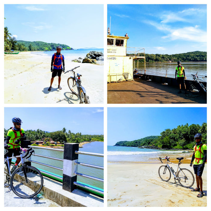
I finally got a very good sleep the night before. Since the route from Gokarna till Palolem was very hilly, we didn't want to end up riding in the jungles in the dark. Our goal for today was to reach Karwar and stay there. Early morning, we had to catch a ferry at Gangavali Ferry Service by 7 am - that will not just save us 15 km, but will also take us through some good routes. We were now preferring these remote routes, after our last find. We reached there on time, the huge ferry was totally empty, and before departing it was full. People used that route daily as part of their commute. Apart from saving time for everybody, it only cost 10 bucks!
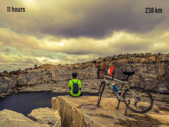
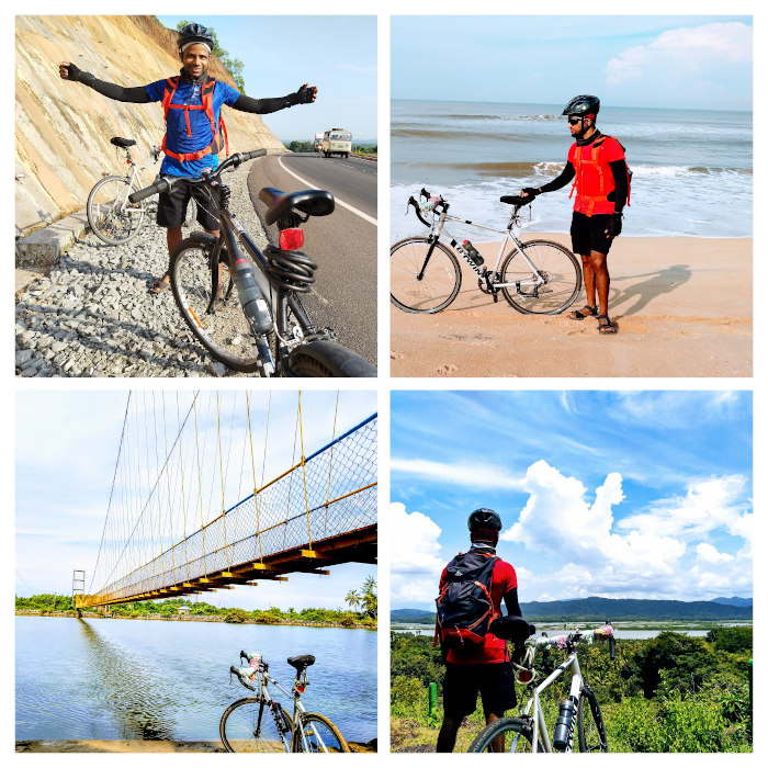
After getting back to the highway, the last 30km before Karwar was very hilly, challenging and there were huge trucks passing by. These hilly routes took us through some big jungles and mountains. (edge of western ghats) By the time we reached the Karwar beach, it was only 12 pm, and even after the challenging route so far we were feeling good. So we decided that we'll continue and go till Palolem on the same day - because even in the worst case, we had 6 hours left. I clearly remember crossing the flat & straight Karwar highway behind the Karwar beach at high speed and I stopped only after reaching a flyover with an amazing view. (photo below)
After entering Goa, I wanted to stop at the Polem beach for some time which is my favorite beach. It's a remote beach and always empty. We went there but didn't waste too much time and moved ahead. The roads of South Goa are very good, have huge trees and it's hilly in most parts. Somewhere in the jungle, we spotted a restaurant. (there was nothing else in that area) We had our usual fish curry meal there, took some rest, and resumed the ride.
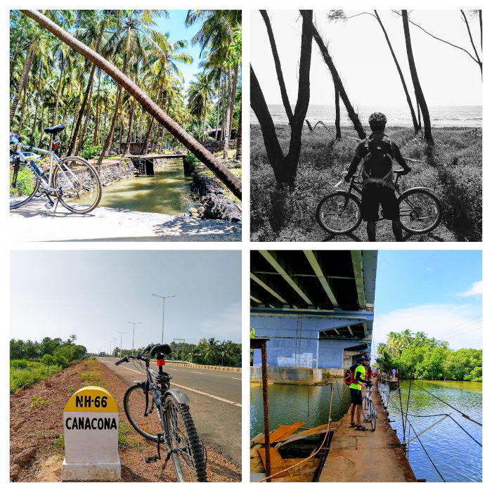
At one point, we saw an under construction bridge, spotted a temporary footbridge to cross Glagibag river. We went off-road and walked on that bridge to reach the Glagibagh bridge. It was rare to spot humans around so far in the trip, but a couple gave us company while crossing that bridge - who were also going to the same beach. We also realized that we were well ahead of our worst-case time scenario and Palolem is not too far. This bridge actually was part of NH-66 that took us directly to Palolem. We reached there by 4 pm, took some rest and went to the beach for the sunset, but the weather was cloudy today. Meh. At first, we thought of spending another day in Palolem, but after some discussion, we decided we'll go to Panjim next day and stay for a day.
Day 5: Agonda, Cola, Panjim (80 km)
Another good night's sleep, we were set to leave for Panjim. However, we decided to take a different route for it. Looking at the map, we saw two ways to reach Margaon. The first one was the familiar NH-66, and the other one was via Agonda and Cola - it's a state highway. At this point, we had no idea how amazing that route is going to be.
When we started riding, it was drizzling, but we kept moving. The route between Palolem and Agonda is familiar (since I had a barefoot run on this road, a year back). We were riding pretty fast, because of the amazing weather. This route was hands down the best in this whole trip. Jungles, hills, and once in a while spotting entire beaches range from the top (Agonda, Palolem etc beaches in one view). Cola was specifically amazing, this place is on ghats and within the jungle. There was nobody there (apart from a few random houses in the center of nowhere) and we could hear sounds of birds and some animals. Sometimes, it was scary as well, because we couldn't ride fast enough (or in fact we had to just walk sometimes because of the large upward slope) I was thinking, if one of those baboons attacked me, I won't even be able to run away.😂 It's hard to describe this route - drizzle, ghats, dense jungles, grass plains, birds and animals. We also spotted a French couple who were coming to Palolem from North Goa on cycle. We talked to them for a while, who were going to Kerala on a cycle over a month period.
We reached Margaon and after this, the roads were crowded with vehicles and people. By 1 pm, we had reached Panjim, and instead of looking for a room, we came to the bus stand and started searching for a bus to Bangalore. But there were no buses available - online or offline. After more than an hour of struggle and convincing about our cycles, a bus driver helped us and offered us two seats on the bus for extra money (extra money for cycles as well as for the seats). We got to know that every government bus has a couple of seats reserved for VIPs and usually it's filled at last moment. We got lucky.
The bus took the same route we came from. Within 2 hours we had already reached Karwar. From the window, we saw all the same places, restaurants and marks we had visited, and now we were passing by them in just a flash.
Afterthoughts
When we go for a long one-day trip, it requires a different mindset and preparation. Because you know that at the end you'll reach home and can rest as much as you want. But a long trip over multiple days requires a different kind of mindset. In this, you need to prepare for the next day's ride again - day after day. Both of them are an unique experience in themselves.
Additional information
Food & Nutrition
Breakfast: generally Idli, Dosa from local shops
Lunch: Fish curry meals and sometimes Dosa
Dinner: Fish curry-rice, eggs/chicken and milk + protein shake before sleeping.
We bought a huge number of water bottles throughout the trip. We always keep packets of Tang and mix in the water bottles.
Stay
We try to find lodges/hotels or home-stays between Rs. 700-1200 per night. It’s very easy to find them at highways and remote areas, plus we don’t look for anything fancy either.
Beached Visited
Malpe Beach, Maravanthe Beach, Murdeshwar Beach, Kadle Beach, Nirvana Beach, God’s Own Beach, Gokarna Main Beach, Karwar Beach, Polem Beach, Galgibaga Beach, Talpona Beach, Palolem Beach.
Bikes
Parkar: Btwin Rockride MTB
Shekhar: Btwin Triban 100
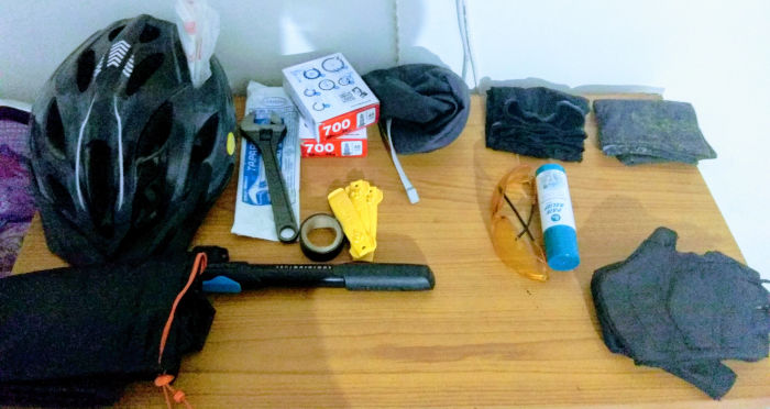
Gears
Get the list from here.
Although right now we don’t have any set plans, we’ll be back on the roads soon!
]]>